Rocha da Pena is geologic monument in protected area of Algarve, Portugal. It is located in the northern side of municipality Loulé – between Benafim and Salir.
Тhe location combines a large plateau over vertical cliffs (northern and southern) of hard limestone that are about 40 – 50 meters high, surrounded by great panoramic view of the Algarvian upland terrain.
The site is extremely rich in terms of its fauna because if its peculiarly fertile red soil with staggering 450 different species of plants inhabiting this predominantly calcareous outcrop.
The bird fauna is reaching over 120 species, includes Eurasian jay (Garrulus glandarius), Eurasian buzzard (Buteo buteo), Bonelli’s Eagle (Aquila fasciata) and redwing (Turdus iliacus). Mammals include Schreiber’s bent-winged bat (Miniopterus schreibersii) and lesser mouse-eared myotis (Myotis blythii), both protected.
There are also historical events connecting Rocha da Pena with the last days of Almohad caliphate when the last remaining parts of the Moors army took refuge there after Portuguese conquest of Salir.
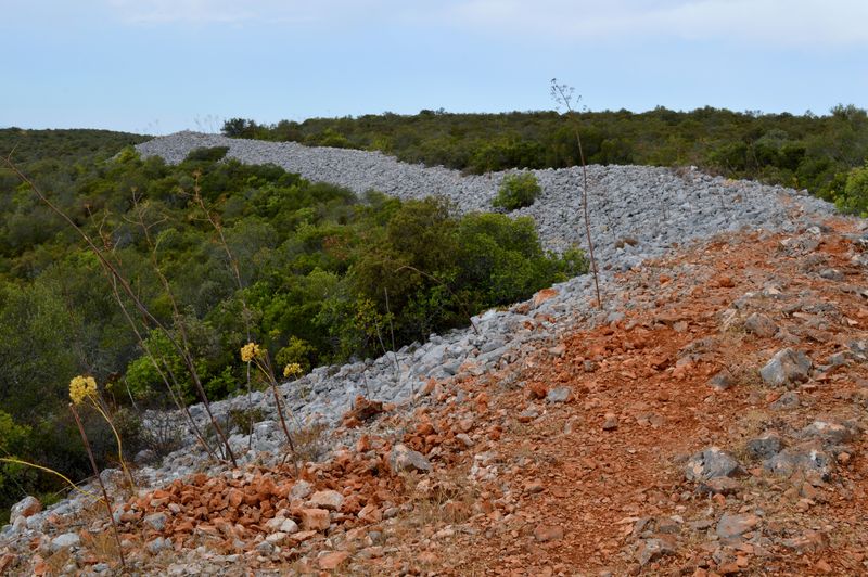
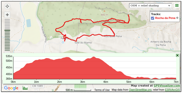
The trail is crossing a Greater Iron Age Defensive Stonewall and passing close to Lesser Iron Age Defensive Stonewall. Both walls have been assembled stone by stone in the times of the Iron age, but also used for short period by the Moors for protection before they have been slaughtered by the approaching crusaders of King Afonso III of Portugal.
These limestone heights of impressive morphology are the largest climbing area in south Portugal with over 100 routes across 2 km of south-facing limestone walls.
The average completion time of the trail is 2.5 – 3.0 hours with short stop for a drink in the beautiful village of Penina.





Great trail with historical value.